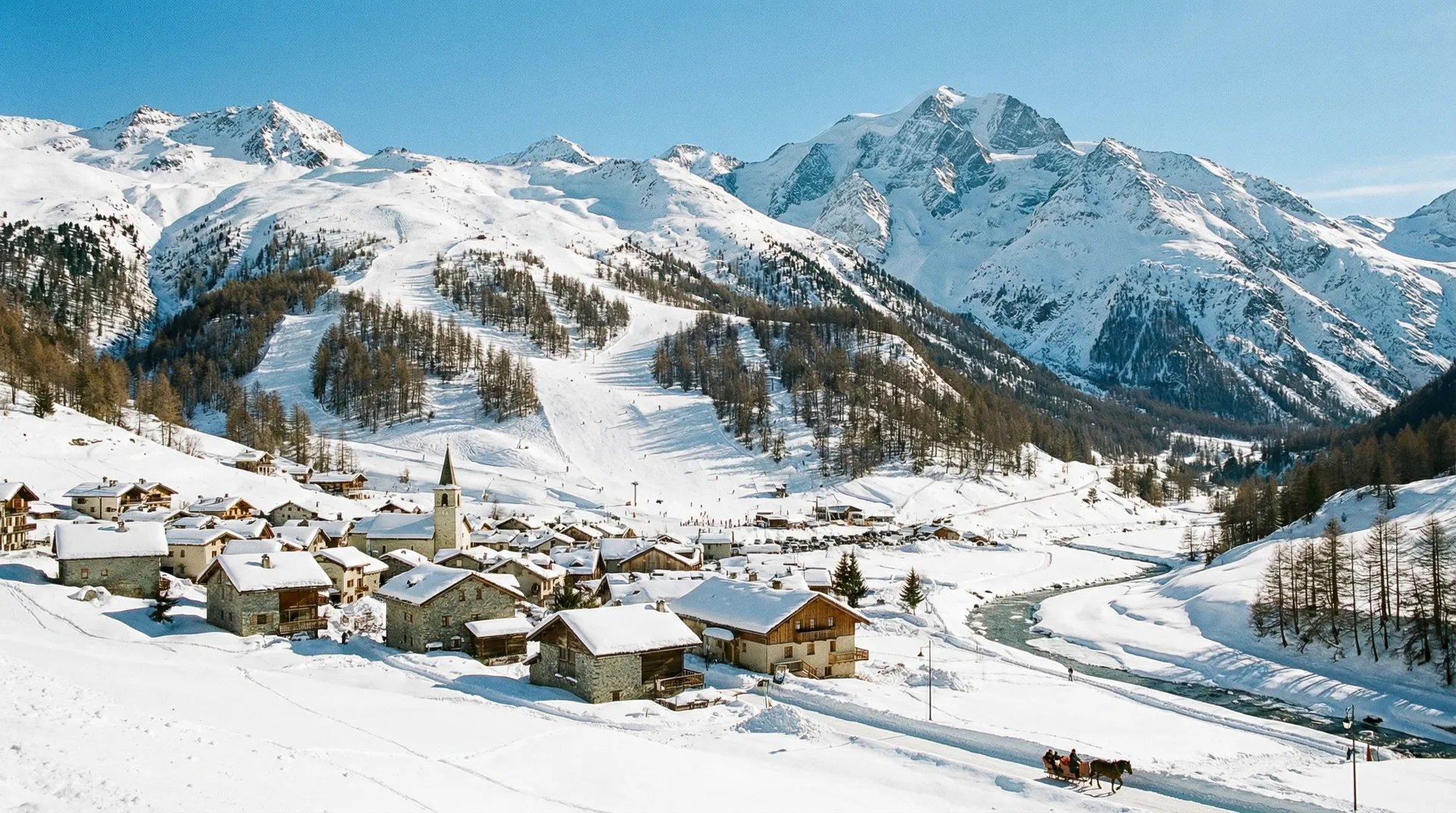
Val Cenis
France
Elevation
1,300m – 2,800m
Lifts
29
Slopes
125 km
Airport
Chambery Airport - 120 km
About Val Cenis
Val Cenis is a large ski area in the Haute Maurienne Vanoise, connecting the villages of Lanslevillard, Lanslebourg, and Termignon. It offers 125 km of slopes for all levels, spanning from 1,300m to 2,800m, and is served by 29 lifts. Chambery Airport is 120 km away.
Details zum Skigebiet
Wichtige Statistiken
Gipfel2,800m
Talstation1,300m
Höhenunterschied1,500m
Gesamtzahl der Lifte29
Gesamtzahl der Pisten125 km
Pisten
Green (Beginner)17
Blue (Intermediate)21
Red (Advanced)22
Black (Expert)5
Bewertungen
Skifahren
Beginners
Intermediate
Snow Guarantee
Skigebiet
Value for Money
Family Friendly
Winter Hiking
Mountain Weather
Skiing: Fair
13°C
Clear Sky
Gefühlt13°C
Wind3 km/h
Luftfeuchtigkeit46%
Schnee59 cm
11°C3°C07:0020:092.800m
5-Day Forecast
Thu
10°C/3°C
—
16 km/h
Fri
10°C/2°C
—
11 km/h
Sat
8°C/3°C
0.1mm
14 km/h
Sun
3°C/0°C
1.5 cm
18 km/h
Mon
0°C/-2°C
8.2 cm
9 km/h
Data: Visual Crossing · Updated 06:32
Ski Area Map
Explore the ski runs and pistes around Val Cenis. Toggle the ski piste overlay using the layer control.

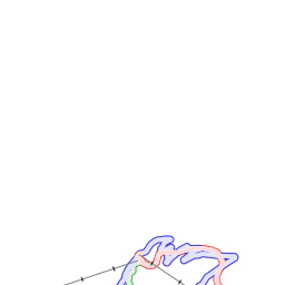


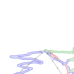

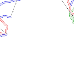
Ski piste data from OpenSnowMap.org (CC-BY-SA)
Bewertungen
No reviews yet. Be the first to review Val Cenis!

More Resorts in Haute Maurienne Vanoise
Explore other resorts in the Haute Maurienne Vanoise ski area